
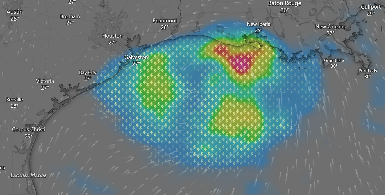
Tropical Storm Edouard is threatening the northwest Gulf Coast with heavy rains, potential strengthening, and flash flood risks. Read the latest update.
Tropical Storm Edouard is bearing down on the northwest Gulf Coast, prompting widespread warnings, flood watches, and rapid preparations across parts of Texas and Louisiana.
The system, tracking steadily through the Gulf, is packing maximum sustained winds of 40 mph with higher gusts and is expected to strengthen further before making its final push inland.
Rapid Intensification Potential Before Landfall
According to updates from the National Hurricane Center (NHC) and local meteorological services, Edouard has developed a compact, well-defined core. Operating over warm sea-surface temperatures near 31°C and under low vertical wind shear, environmental conditions are primed for additional strengthening.
Forecasters warn that the storm could approach near-hurricane strength just before making landfall along the upper Texas or southwest Louisiana coast.Tropical storm conditions are currently active along the northwest Gulf Coast, with localized hurricane conditions possible within warning areas stretching from High Island, Texas, to Cameron, Louisiana.
Torrential Rains and Flash Flood Risks
While coastal regions brace for gusty winds and a potential 3-to-5-foot storm surge, emergency management officials emphasize that the primary threat from Edouard will be heavy, persistent rainfall.
A Flood Watch remains in effect across the eastern half of Southeast Texas and parts of southwest Louisiana, covering major metropolitan zones including parts of the greater Houston area.Forecasters project widespread rainfall totals of 3 to 5 inches, with isolated, heavier downpours reaching up to 6 to 9 inches east of Interstate 45.
“With any tropical system, you could get some gusty winds, especially near the coast and offshore,” noted National Weather Service forecasters. “For those inland, metro area and northward, we are looking primarily at a significant rainfall impact.”
Emergency Response and Travel Disruptions
Local school districts, municipal authorities, and transportation agencies have mobilized emergency response protocols ahead of the landfall.Flash flooding risks remain elevated for low-lying urban sectors, streets, and poorly drained highways as the system pushes further inland.
Meteorologists expect Edouard to maintain its northwest trajectory through Tuesday night before rapidly weakening to a post-tropical remnant system as it moves deeper over land. Residents in the path of the storm are advised to monitor local weather alerts and avoid driving through flooded roadways as the core moves ashore.