
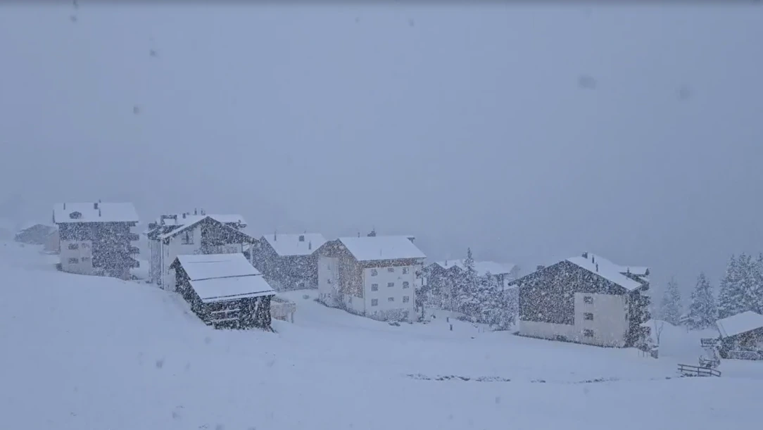
The first snowfall of the 2025–26 winter season arrived in the Alps on 25 September, dusting Swiss, German and Austrian peaks with 5–25 cm of fresh powder as low as 1,400 m. Webcams, ski resorts and meteorologists confirm the white blanket—an increasingly typical date in a warming climate.
ZURICH/BERLIN -A sharp early-season cold snap sent 0°C isotherms plunging to just 1,400 metres above sea level on Thursday, triggering the first region-wide snowfall of autumn across the European Alps.
From Switzerland’s Jungfraujoch to Germany’s Zugspitze and Austria’s Hintertuxer Gletscher, webcams lit up social media with images of pristine white slopes barely a week after the equinox.
Key Facts at a Glance
- Date of first snow: 25 September 2025 (overnight 24–25 Sep)
- Snow depth: 5 cm Säntis & Pilatus, 15 cm Saas-Fee, 25 cm Hintertux (glacier)
- Snow line: 1,400 m (W-Alps), 1,700 m (E-Alps)
- Lowest temperature: –7.3 °C on Säntis summit (2,502 m)
- Outlook: Rapid melt above 2,000 m this weekend; no valley snow expected next 10 days
Weather Setup: Why It Snowed So Early
A powerful upper-level trough, driven by a 150-knot jet stream, dug south from the North Sea on Wednesday, pulling Arctic maritime air across France and into the Alps, explains MeteoSwiss meteorologist Sandra Müller.
“Thickness values dropped below 5,340 gpm—classic early-winter numbers,” she said. Combined with orographic lift, the saturated layer produced 6–8 hours of continuous precipitation above the freezing level.
Switzerland: “Winter Arrived in One Night”
- Zermatt resort services measured 12 cm on the Theodul Gletscher by 07:00 Thursday; ski-area crews already groomed the snow for this weekend’s glacier skiing opening.
- Pilatus (2,073 m) webcam recorded the first flakes at 02:15 and a full white coat at sunrise—images shared 1.4 million times on Instagram within 12 hours.
- SRF Meteo titled its noon bulletin “Erster Schnee – die Wintersaison hat begonnen,” while 20 Minuten called it “Schnee-September – so früh wie seit 2018 nicht mehr.”
Germany: Bavarian Summits Spark Headlines
- Zugspitze (2,962 m) registered 8 cm; the mountain railway reported “winter service” mode for the first time since May.
- Oberstdorf/Nebelhorn footage posted by @wetter_de reached 3 million views, with Bild.de running “Schnee-Alarm im September!” on its front page.
- German Weather Service (DWD) climatologist Thomas Deutschländer notes that first September snow at 2,000 m now occurs roughly every two years, compared with every five years in the 1990s.
Austria: Glacier Resorts Celebrate “Bonus Month”
- Hintertux (3,250 m) saw 25 cm; resort management advanced snow-making tests originally scheduled for mid-October.
- Pitztal glacier tweeted “Opening on 18 October? Maybe earlier—thanks, Mother Nature!”
- ORF Tirol warned hikers of wind-chill near –15 °C on exposed ridges.
Climate Context: Early Snow, Warm Globe
While spectacular, the event fits a broader trend identified by the Zurich-based Central Institute for Meteorology (ZAMG): autumn snow extremes at high altitude are increasing even as average temperatures rise.
“A warmer atmosphere holds more moisture; when cold air still arrives, that extra moisture falls as heavy snow,” says climate researcher Dr. Marc Olefs. The past eight Septembers have all produced at least 10 cm of snow somewhere above 2,000 m in the Alps, compared with only four such cases in the 1980s.
Ski-Industry Reaction: “Cash-Register Sound in September”
Resort operators are upbeat. “Every webcam shot of fresh powder is free advertising,” says Swiss glacier-ski spokesperson Anna Bianco. Saas-Fee expects 8,000 weekend visitors instead of the usual 3,000, while lift companies in Sölden report a 40 % spike in online ticket sales within 24 hours.
Nonetheless, experts caution that this snow will largely melt below 2,500 m next week as temperatures rebound to 18 °C in valley stations.
Traffic & Safety Alerts
- A13 San-Bernardino: brief chain obligation for trucks above 1,600 m Thursday morning.
- A10 Tauernautobahn: frost-slick sections near Katschberg; no major accidents.
- Swiss Alpine Club advises hikers to carry micro-spikes and avoid north-facing gullies where wet snow could avalanche.
Five-Day Forecast
High pressure will build from the Azores on Sunday, bringing dry weather and +5 °C warming at 2,000 m. Only residual patches above 2,800 m are expected to survive; no new snow is forecast before 4 October.
What the Papers Say (Selection)
- Blick (CH): “So früh schneit es nur alle paar Jahre – diesmal sogar vor dem Oktoberfest!”
- Süddeutsche Zeitung: “September-Schnee ist kein Klimawiderspruch – er ist Teil davon.”
- Kronen Zeitung (AT): “Erste Schneekanonade: Wintersportorte jubeln.”
FAQ – First Snow Alps 25 September 2025
Q: Is this unusually early?
A: At 3,000 m, no—at 1,500 m, yes. Snow in late September occurs about once every 3–4 years since 2000.
Q: Will the snow stay?
A: Above 2,500 m some will persist; below that it will melt over the weekend under strong September sunshine.
Q: Does this predict a long, snowy winter?
A: Not necessarily. Early snow is driven by short-term weather patterns, not seasonal forecasts. Long-range models show neutral ENSO conditions with average Alpine temperatures for Dec-Jan-Feb.
Q: Are roads affected?
A: Only high passes (Furka, Gotthard, Grossglockner) had temporary slush; all are open and clear now
Thursday’s powder dump was a visual reminder that winter can gate-crash autumn in a matter of hours. For skiers, it’s a welcome marketing gift; for scientists, another data point in the debate over extreme weather in a warming world. If you’re heading to the high Alps this weekend, pack sunglasses—the snow will sparkle, but it may be gone by Monday.